More than the West Highland Way
Hiking around Scotland has been a lifelong dream. My oldest niece was born there and so my family visited when I was 3. I have a few vague memories, but nothing more. Yet, since I started backpacking, I’ve been fascinated with exploring Scotland on foot. As I began to plan the trip it became evident that Scotland had no shortage of trails to hike…or hill walk as they call it.
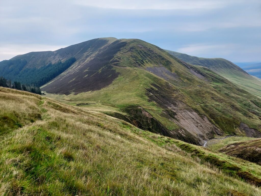
Scotland has 24 long distance walks or ways, so my husband and I set out to explore the country using this network of trails combined with the numerous public paths through fields and towns. We utilized 14 of the long walks over the 10 weeks we were there—hiking nearly 1400 miles while looping the country and climbing 50 Munro peaks (a list of 282 of the highest mountains in the country). Below is a brief outline of our trip to spark your imagination to plan your own Scotland adventure!
Perhaps the most internationally famous walk is the one we started with: the West Highland Way. Although the track itself is not particularly interesting or challenging to those used to the American backcountry, it was a fantastic method for connecting Munro peaks. We completed the 96-mile-long West Highland Way (plus 27 Munros) in 12 days. The 27 Munros we climbed were a huge undertaking and required a wide variety of mountaineering skills. Even if peaks are not your thing, I highly recommend adding at least Ben Lomond and Ben Nevis to your West Highland Way trip if you have good weather.
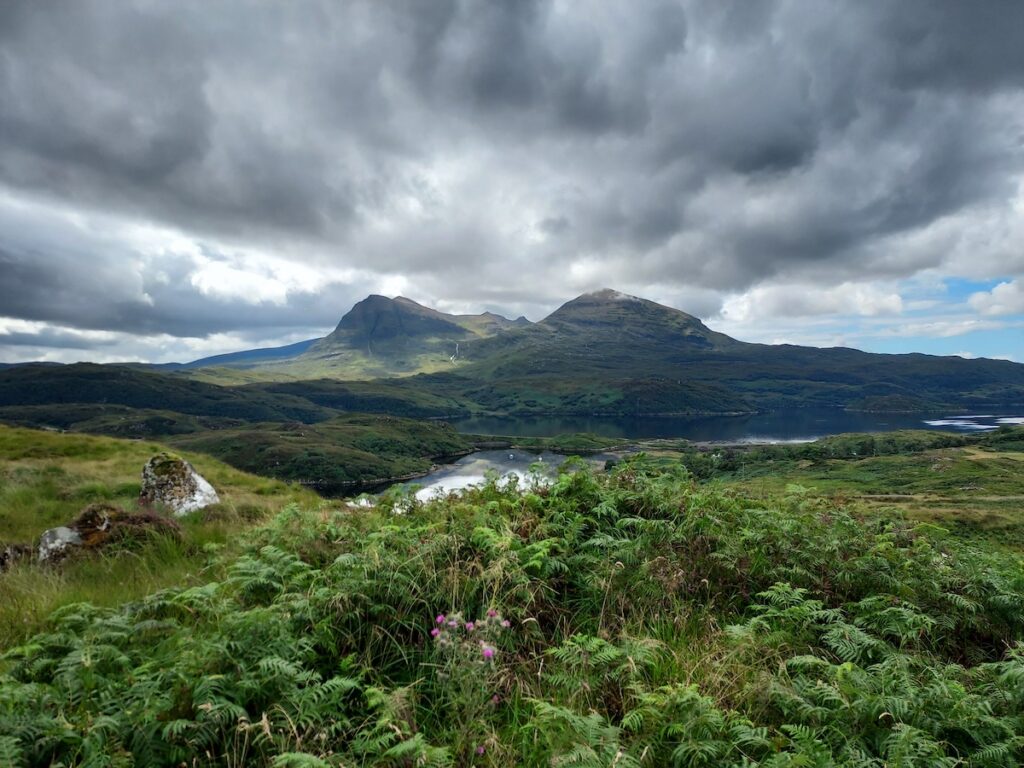
From Fort William we hiked northwest along the Great Glen Way before cutting north over to the Affric-Kintail Trail in order to connect with the primary Cape Wrath Trail Route at Shiel Bridge. Once off the West Highland/Great Glen Way, we experienced “real” highland hiking, which amounted to trudging through a lot of boggy ground without any sign of a trail. This segment was wet and loaded with ticks as we fought through overgrown bogs and trailless regions. However, we also crossed a beautiful valley where the oldest tree in Scotland supposedly grows.
At Shiel Bridge we waited in a bus stop for 3 hours as it poured rain. In our entire time in country, this would end up being the wettest day we experienced. Finally, we loaded onto the bus full of other tourists and were deposited on the Isle of Skye. Here we bought supplies and walked out of town on the 80-mile Skye Trail.
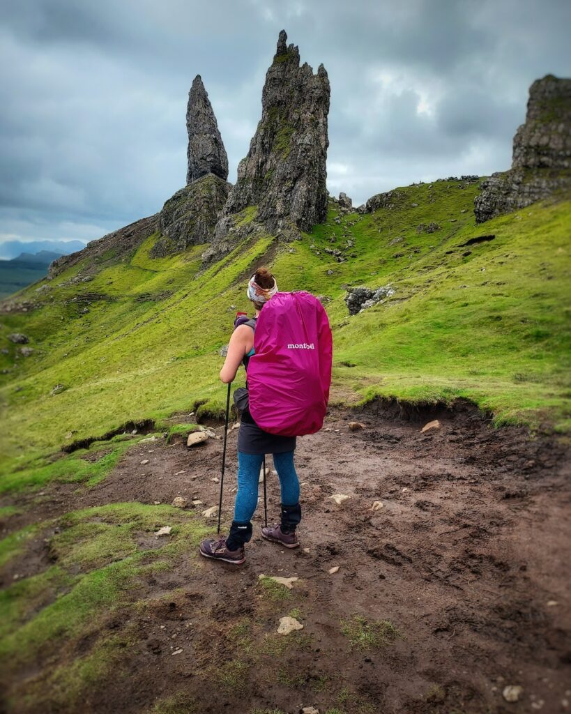
Skye is well known for its history and stunning vistas. Being in the backcountry on the island was jaw-dropping. We saw very few other people, ascended a Munro in complete white-out blowing fog, and had an RAF aircraft roar through a wide valley just a hundred feet over our heads. We crossed seaweed strewn tidal flats, got up close and personal to the famous rock feature known as the Old Man of Storr, and finally traversed the Trottenish Ridge.
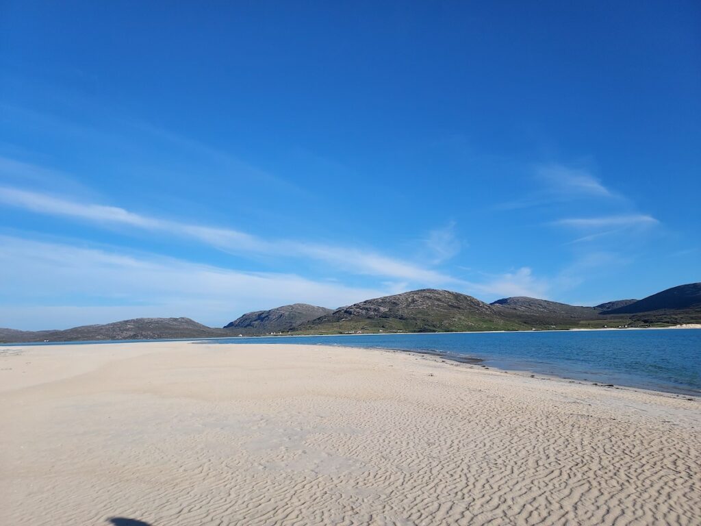
We dipped down off the ridge at the north end of the island to walk into Uig where we took a ferry to the Isle of Harris and Lewis. Here were walked and hitched using bits of the Hebridean Way to see Luskentyre Beach, which—since it was 70 degrees—seemed like the Caribbean, as well as climb the high point of the island—Climash—and see the Callanish Standing Stones. The Outer Hebrides islands are not heavily visited comparative to many other places in Scotland, but we found them to be absolutely beautiful, albeit windy. There wasn’t anything west of us there until Canada. This was especially apparent on the summit of Climash where the 80+ mph winds flattened us against the rocks as we fought against the unbroken wind roaring off the north Atlantic.
A ferry from Stornoway back to the main island brought us to Ullapool. From there we plunged into the really remote highlands along the Cape Wrath Trail, which actually is not a trail, but more of a route. This took us to some breathtaking vistas, past castle ruins, and to a pink sand beach. It ended at the most northwestern point of the UK at the Cape Wrath lighthouse.
Over the next couple of weeks, we used buses and hitchhiked in between walking roads to explore the Orkney Islands and Caithness. Back south in Inverness we bought supplies and hiked southwest on the Great Glen Way again, nearly connecting our steps from the beginning of our trip. However, at the head of Loch Ness we continued around the lake to hike the South Loch Ness Trail back to Inverness. This so-called Loch Ness 360 loop was actually one of our favorite hikes of the entire trip. The trail is a legitimate trail, often on forest roads, and traveled through some lovely pine forests which were lacking in the west and northern highlands.
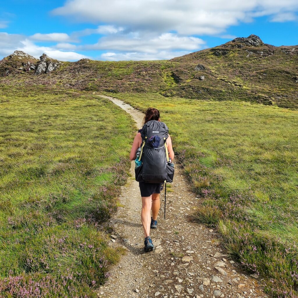
A short train ride took us to the start of the Dava Way, which was an interesting route through empty moorlands on a rail trail. The weather was dreary, but not cold. The Dava Way teed into the Speyside Way which we followed to Nethy Bridge. The Speyside is well known around the world for its whisky making, but we were more interested in what lie on the far side of the Spey: The Cairngorm Mountains.
We spent a week climbing Munros in Cairngorm National Park as well as the greater Cairngorm Region. This was our favorite part of the entire trip. The mountains had an austere beauty, jewel watered lakes, reindeer(!) and good trails. We even saw the only native snake in Scotland, the venomous adder. Unfortunately, the weather deteriorated rapidly while we were in the middle of a long Munro traverse. We had to navigate by GPS only and camped behind a snow fence near a ski lift in the pouring rain on saturated boggy ground.
After drying out at the ski resort restaurant in the morning we made the decision to hike 5 miles down the highway instead of ascending the other side for more Munros. This brought us to the Spittal of Glenshee where we joined the Cateran Trail. This trail took us down and away from the Cairngorm High Country and out of the wet, cold weather. The Cateran was a great trail in some places, and rather rough in others so we were more than happy to get on a bus in Blairgowrie and head to the Fife Peninsula.
We circled the Fife Peninsula on the Fife Coastal Path, which took us through many small fishing villages as well as Saint Andrews—famous for its college, ancient cathedral, and as the birthplace of golf. The coastal hiking along the North Sea was truly stunning and we thoroughly enjoyed the time we spent there.
At the Queensferry Bridge, we left the Fife Coastal Path and joined into the John Muir Way which we followed into the city of Edinburgh. We’d now looped the entire highlands and looked to the south for what we’d do with the final two weeks of our trip. We opted to take the train to Galashiels and hike the middle of the Southern Upland Way to Moffat.
We were surprised at how incredibly beautiful the Borders were! Huge rolling mountains and beautiful lochs were everywhere. It was also a place dense with history. Many plaques and structures remain to tell the stories along the trails. This was very different from our experiences in the highlands where there were no real interpretive signs in the backcountry. At Moffat we went south on the Annandale Way which led us to the Solway Firth and the English Border. The extensiveness of our travels was made possible by the Scottish Outdoor Access Code which allows for responsible (think LNT) human powered travel and camping on all land—public and private. This code truly opened up the opportunities for us to really see the entire country on foot. If you’d like to backpack extensively in Scotland, familiarize yourself with the code before you head out. While the code still applies for the majority of Loch Lomond and the Trossachs National Park, there are some areas in the park where you must get permits to camp. We were able to avoid dealing with that by camping outside those areas. Other helpful tips are to look up bus, train, and ferry schedules in advance. Booking your tickets even the day before can save you a lot of money, especially on the buses. Perhaps most importantly, have reliable rain gear and a positive attitude. Scotland can be a very challenging place to live outdoors!


