
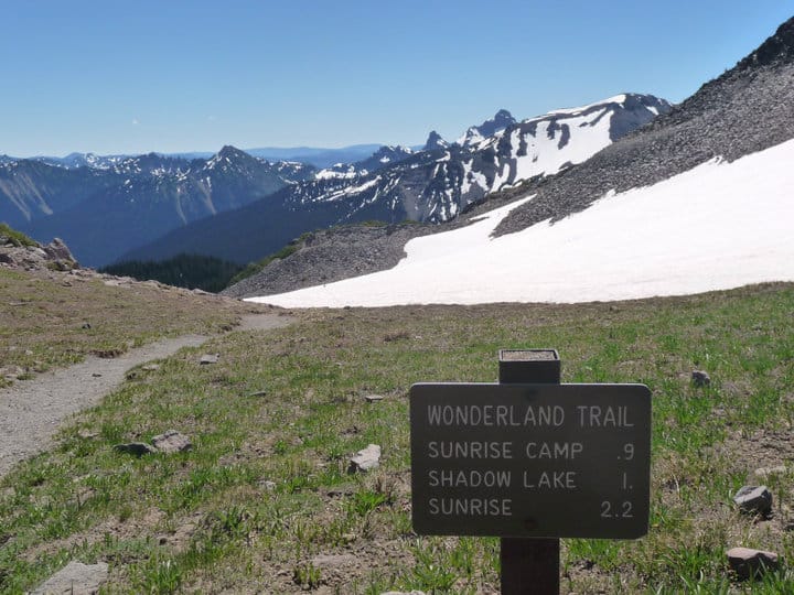
The Wonderland Trail at a Glance
- Location: The Wonderland Trail circumnavigates Mount Rainier, the highest peak in Washington State.
- Length: ~93 miles
- Average Hiking Duration: 1-2 weeks
- Season: July-September
Permits
Since the entirety of the trail is inside Mount Rainier National Park, permits are necessary for all overnight trips. These are limited and competitive. You must camp in designated campsites. There are 18 backcountry sites and three non-wilderness sites available.
Permits are available in advance or as walk-up. However, itineraries that utilize walk-up permits are seldom going to meet your preferences.
The permitting process is complicated. Detailed step-by-step instructions are found on the National Park website: https://www.nps.gov/mora/planyourvisit/wilderness-permit.htm
Starting Point and Direction of Travel
Since the Wonderland Trail is a loop hike, you can start at any point along the trail and go either clockwise or counter-clockwise. This is especially convenient if you are trying to work with walk-up permits. However, most people choose to start and finish at Longmire and travel in a clockwise direction.
Navigation
There are many different trails inside Mount Rainier National Park. Generally the intersections are well-marked, however, having maps and a compass and digital navigation devices are crucial. Snow can linger well into late summer, obscuring the trail. Glacial rivers can also rearrange the topography leading to on the ground confusion.
- By far the most common navigational too used is the FarOut app. This provides GPS navigation, waypoint information, and live user input for up-to date information about water sources and other on trail information. You can get it here: https://faroutguides.com/wonderland-trail-map/
- The NPS provides elevation profiles and trip planners for reference during planning as well as on the trail. You can access them here: https://www.nps.gov/mora/planyourvisit/the-wonderland-trail.htm
Brief Description
The Wonderland Trail may clock in at less than 100 miles, but it is an incredibly strenuous hike. Thru-hikers will likely log over 3,000 feet of gain per day. The trail traverses thickly forested lowlands and ascends along glacial rivers into sub- and alpine terrain. Stunning views are readily available above treeline.
Weather
While the trail traverses a great deal of open parklands, the WT is prone to inclement weather. You may spend days hiking in fog and rain without seeing much of anything. Wet conditions in the open can feel much colder since there is nothing to break the wind or protect you from the precipitation. A heavy duty set of rain gear is essential and a double wall tent is highly recommended. When the sun is shining, sunglasses and a good hat are essential to protect yourself from the prolonged sun exposure.
Conditions
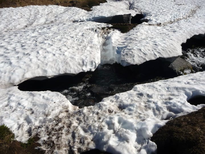
As mentioned earlier, snow can linger well into the summer at higher elevations. This can mean many miles of navigating on snow, negotiating snow bridges and steep slopes, as well as exhausting post-holing. Depending on the time of your hike and the previous winter snowpack you may need an ice axe, traction for your footwear and/or snowshoes.
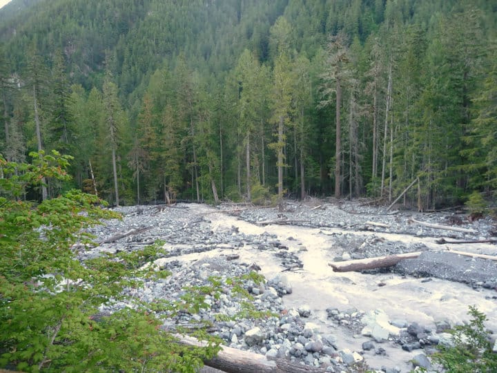
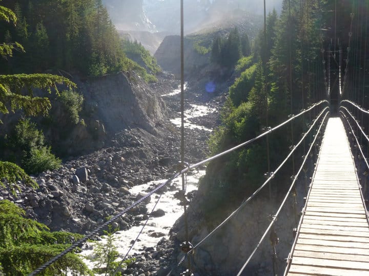
Additionally, flooding happens regularly along the glacial rivers, especially in spring and early summer when the snow is melting. This can wash out sections of trail and take out bridges. Temporary reroutes may be in place and you may need to negotiate unstable slopes.
Be sure to monitor trail conditions on the park website in the weeks leading up to your trip. Evaluate your skills and gear and make sure they match the conditions you’re likely to encounter. Despite the trail’s popularity, much of it is incredibly remote and if you find yourself in over your head, rescue can take a long time. The WT is a tremendous challenge packed into a short trail. While it’s beauty in clear conditions is unparallelled, it should not be underestimated. Despite the difficulty, thru-hikers will find it to be an incredibly rewarding experience.