Last April, I thru-hiked the ~250-mile Tuscarora Trail, originally called Big Blue Trail in MD, WV, and VA and the Tuscarora Trail in PA. This lesser known thru-hike was a stellar spring hike, although not for beginners. It was challenging, remote, and beautiful. It often has a bad reputation for being very dry, covered with unpleasant overgrowth (poison ivy and briars) as well as being laden with ticks. Therefore, April is a prime month to hike it.
The trail was initially proposed as a possible alternate to the Appalachian Trail on ridgelines to the west of the Shenandoah to Cumberland Valley portion because of anticipated development and loss of land access. However, the anticipated encroachment on the Appalachian Trail corridor never came to pass and the Tuscarora Trail was largely unused for many years. In the 1990’s the Potomac Appalachian Trail Club took over responsibility for reopening it. The PATC revived the trail, began maintaining it, and united the Tuscarora-Big Blue Trail with blue blazes and one name. The club also built several shelters along the route as well. Despite this, the Tuscarora Trail remains a seldom traveled long trail.
If you’re looking for an adventure in the wild east this spring read on!
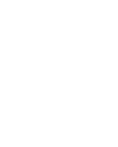
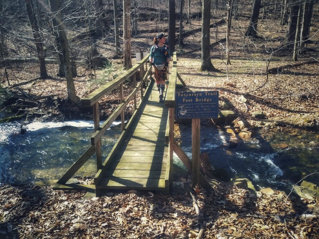
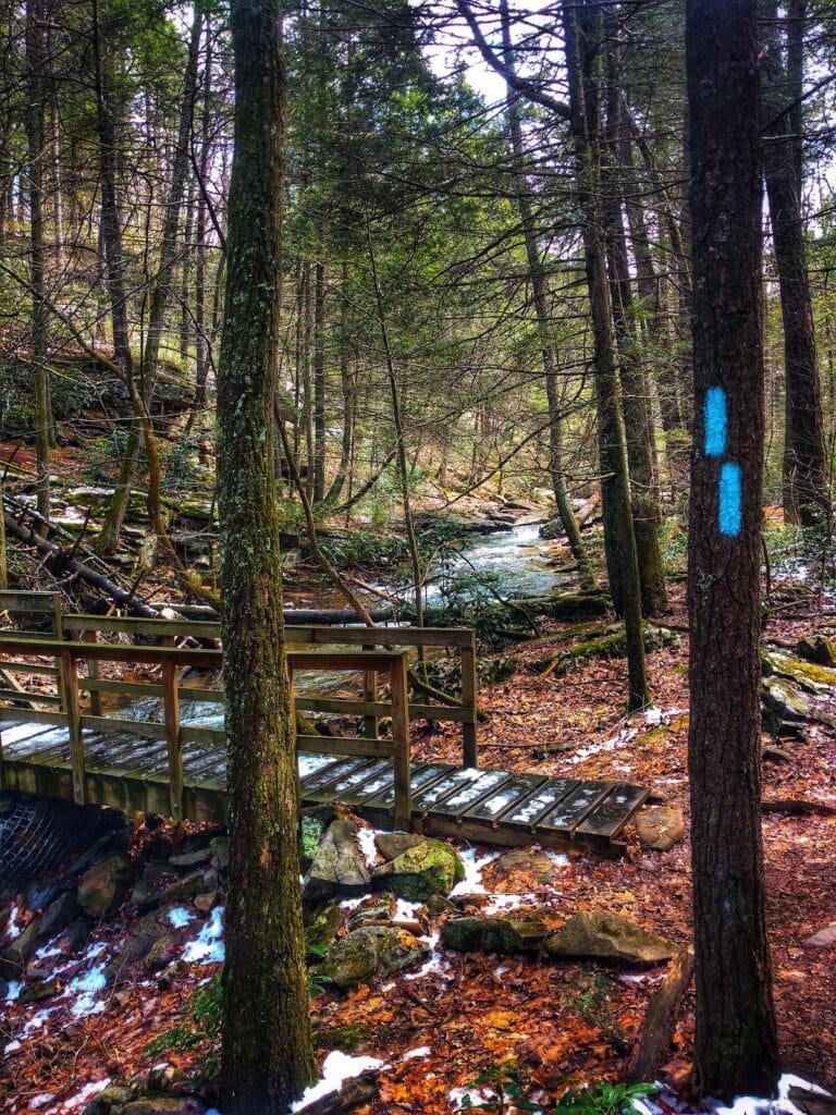
The Tuscarora Trail is well marked with blue blazes and signs, however there are some very long stretches on the ridgelines in PA without trail tread. In these sections the trail is all talus style rock. Because of this, travel can be very slow. There are adequate springs in the early season, however in late season they often dry up, adding a layer of challenge. There are only a few options for convenient resupply. There is also an 11-mile road walk in the middle, which is quite dangerous without shoulders. The PATC is working on gaining easements to move the trail off of roads.
On the plus side, the Tuscarora Trail had more wildlife than the bypassed Appalachian Trail portion (which I hiked back to my starting point, creating a 400+ mile long “Tuscalachia Loop”) simply because it is not used by many people. On it I saw multiple porcupines, a Timber Rattlesnake, many wild turkeys, and deer among other animals.
You can’t drive to either terminus of the Tuscarora Trail. Since I hiked a loop, I started on the Appalachian Trail in the Cumberland Valley, PA and hiked about 5 miles to the start of the TT on Darlington Ridge. If you’re not hiking the loop, you can reach the northern terminus in about 3 miles from the Darlington Trailhead. The southern terminus is about a half mile from Skyline Drive in Shenandoah National Park.
Hiking in the spring had many benefits. Throughout the hike there were many spring flowers in bloom. Although the trail was often slightly overgrown, there were only a few occasions where fighting briars and fallen trees was truly demoralizing. Overall, the majority of the route is a mixture of old road, paved road, and singletrack. Although the rocky segments are incredibly slow-going. These sections require walking on continual talus like rocks for miles at a time, mostly in Pennsylvania. This cannot be overstated. In these sections my hiking speed was cut in half! These sections also are among the driest and therefore I had to carry a lot more water than I normally would for that distance. The benefit of hiking in April was that all water sources were flowing so that it was never more than 17 miles between on-trail water. If you go at another time of year, be prepared to have to hike off trail (sometimes a mile one way!) to access water.
Of note, is that since the Pennsylvania portion of the Tuscarora Trail passes primarily through state game lands (as well as some wildlife preserves and remote undeveloped private land) there are restrictions on camping. The guidebooks from the PATC provide the information you need to plan your overnights at shelters or legal camp sites.
There is only one National Forest on the Tuscarora Trail—the George Washington and Jefferson—comprising much of the land management for the Tuscarora Trail in Virginia. The national forest is split into the eastern and western halves by the valley of the North Fork of the Shenandoah River. After crossing the river, you ascend Massanutten Mountain which is topographically quite interesting, albeit very rocky. After descending from there, you cross the Shenandoah valley mostly on pleasant rural roads with a short distance on a very busy highway before crossing through private land using an old cobblestoned rail tunnel. After this unique feature there is a very long ascent through Shenandoah National Park up to rejoin the Appalachian Trail at the southern terminus. Along the way the Tuscarora showcases some beautiful locations in the national park including Overall Run Falls—the highest falls in the park.
If you enjoy history, the Tuscarora Trail passes by a great deal of historic places, including a woods road from the 1700’s that was used to connect the town of Carlisle with trade to the west, the Mason-Dixon Line, and utilizes a segment of the C&O Canal Towpath along the Potomac River. Another historic highlight of the Pennsylvania portion of the Tuscarora Trail was crossing through what’s known as Path Valley. In the late 1700’s onward many waves of Tuscarora Native Americans migrated northward through the region as they were pressured out of their lands to the south. Their ultimate destination was among the Iroquois nation in the north, but often times they settled temporarily along the way. Thus, the migration took place over many decades and they left their name on numerous locations throughout the region, including the Tuscarora Trail. However, unlike the current trail, the Tuscarora people traveled through the valleys—Path Valley being one of them.